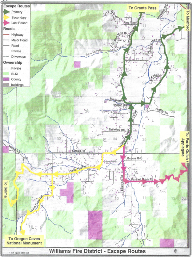
Williams Evacuation Routes
Scroll down for three downloads that show the same William’s evacuation routes—each presented with a different level of detail.
BLM Evac Routes (5.4 MB)
This map shows the evacuation routes from Williams to both Highway 238 and Selma. It also includes designations for land ownership and fire district boundaries.
BLM Evac Routes and Roads (6.4 MB)
This map includes the same information as the WRFPD-BLM Evac Routes map but also includes designations for BLM roads, County routes, Forest Service roads and private roads.
Williams Evac Routes (1.4 MB)
This is the evacuation routes map that was created several years ago. It shows the Williams end of each of the evacuation routes.